Weather Calibration
An understanding of how to determine a good direct & diffuse map is required when using non-CIBSE weather files.
Sky Model & Direct/Diffuse Map
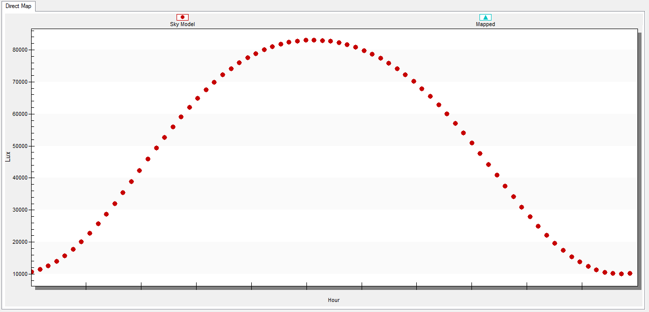
If a clear sky sunny daylight calculationis performed in Tas3D every 5th day of the year at 12pm, the following relationship between illuminance and hour of the year is obtained, which is dependent on the location of the building:
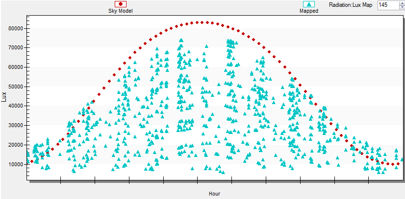
If the sunny hours from the weather file are added to this graph, a similar curve should be observed. In this case, sunny hours are defined as those when the direct solar radiation is greater than twice the diffuse solar radiation:
A factor, the ‘Radiation: Lux Map’, is introduced in order to map and therefore convert solar radiation from the weather files to lux. A factor is required for both direct and diffuse radiation.
How to map weather
When mapping weather, the goal is to try to ensure that the area of points above the red sky model line in winter (green, edges) is approximately equal to the area of points below the sky model line in summer (purple, middle).
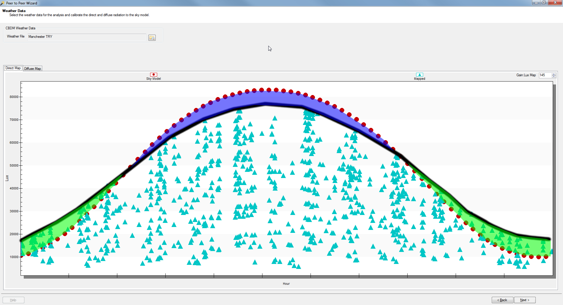
The above image shows a good fit for the direct global radiation component Manchester TRY weather file.
It is important to be consistent with the direct/diffuse map for a particular weather year so that multiple calculations are comparable.